Imagine stepping onto your porch in Stevensville and hearing the Bitterroot River move past while the mountains glow. Buying riverfront here can deliver that dream. It also brings unique questions about floodplains, public access, permits, wells, and insurance. In this guide, you’ll learn what to check, which rules apply in 59870, and how to set yourself up for a safe, smart purchase. Let’s dive in.
Why Stevensville riverfront stands out
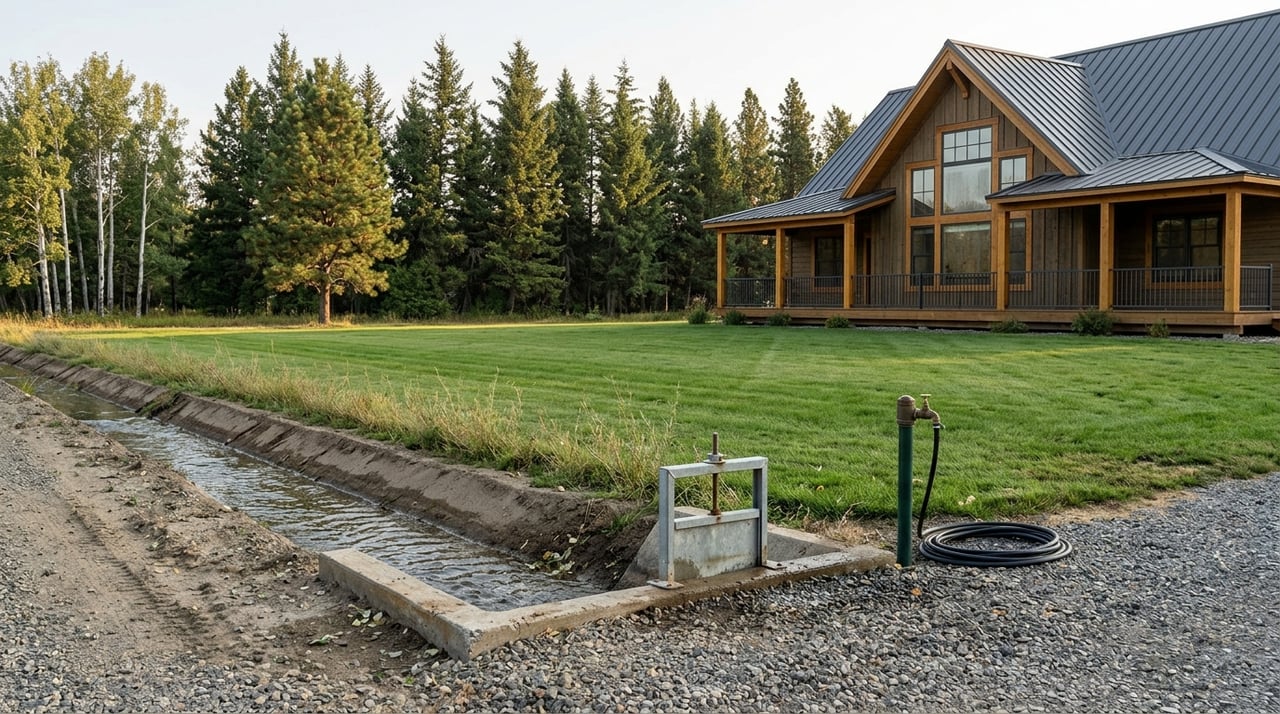
Stevensville sits along the Bitterroot River with nearby creeks like Kootenai Creek and Burnt Fork. You get big-sky views, wildlife, and close-to-town convenience. Riverfront buyers often come for fishing, privacy, and a slower pace.
What makes this area special also makes it technical. Flows are seasonal, banks can move, and certain projects need permits. A clear plan keeps the lifestyle you want on track.
Floodplain basics you must know
Much of Stevensville’s river and creek frontage lies in mapped flood hazard areas. Ravalli County administers local floodplain permits and uses FEMA maps to determine if your parcel is in a regulated area. Start your due diligence by getting a county floodplain determination and reviewing the county’s rules for building and site work. You can find the program overview on the county’s Floodplain page at the Planning Department site: Ravalli County floodplain administration.
For a second check, look up the property in FEMA’s Map Service Center to see the official mapping and any Letters of Map Change: FEMA Map Service Center. If a home or building site falls inside a Special Flood Hazard Area, expect lender-required flood insurance and extra design considerations.
Stevensville’s rivers and creeks run highest in spring and drop in late summer. USGS gages in the valley, including a station at Bell Crossing near Victor and sites on Kootenai Creek and Burnt Fork, show historical peaks and seasonal trends that help you understand risk and access. Review the nearest gage data here: USGS Water Data inventory.
Stream access rules and your privacy
Owning to the water’s edge does not always mean exclusive use of the water for recreation. Under Montana’s Stream Access Law, the public may recreate in rivers and streams capable of recreational use up to the ordinary high-water mark. Learn the basics here: Montana Fish, Wildlife & Parks stream access overview.
What this means for you: anglers or floaters can legally use the wetted channel and gravel bars below the high-water mark, even where the bank touches private land. Legal access to reach that water still depends on bridges, public access points, or easements. During title and survey review, confirm any recorded public or private easements and make sure boundaries are clearly posted per law.
Permits, bank work, and who approves what
If you plan to stabilize a bank, restore a side channel, or do in-stream work, expect multiple layers of review. Ravalli County requires floodplain permits for many projects in mapped areas and calls for engineered designs that use the least environmentally damaging practicable methods. The regulations allow bioengineering, such as willows and brush mattresses, and may combine vegetation with rock where justified. The county can require maintenance and allow up to five years for vegetative components to fully establish. Read the county regulations here: Ravalli County Floodplain Hazard Management Regulations.
Most in-channel projects also trigger federal and state reviews. The U.S. Army Corps of Engineers regulates Section 10/404 activities, and projects may also need state water-quality certification. Check permit pathways and timelines on the Corps’ site: USACE Regulatory Program overview.
Practical tip: budget time for coordination. Non-emergency reviews commonly run 60 to 120 days or more, depending on scope and site conditions.
Septic, wells, and water rights near the river
If the property uses a septic system, Ravalli County Environmental Health will review permits and setbacks. The county flags added review if a system is within 300 feet of a mapped floodplain and may require tests for new or expanded systems. See current procedures here: Ravalli County Septic Permits.
Private wells add another layer. Ask for well logs, test water quality, and confirm well location relative to the floodplain and septic system.
Irrigation or diversion rights are separate legal interests in Montana. They do not automatically transfer with the land. If you want water for pasture, landscaping, or ditches, verify state records and any ditch-company documentation early. Start with DNRC guidance: Montana DNRC stream permitting and water-rights information.
Insurance and financing for riverfront
If a structure lies in a Special Flood Hazard Area, most lenders will require flood insurance. FEMA’s Risk Rating 2.0 brought property-specific pricing, so premiums now reflect things like elevation, flood openings, and utilities. Ask for prior elevation certificates and current quotes rather than relying on past premiums. For a plain-English overview of Risk Rating 2.0, see this summary: Risk Rating 2.0 background for agents.
Ways to reduce potential premiums can include elevating utilities and, where practical, elevating or floodproofing livable space. Always confirm with your insurer how mitigation will affect your specific quote.
What drives pricing in 59870
River and creek properties in the Bitterroot Valley vary widely in price. Values depend on several parcel-specific factors:
- Amount and quality of waterfront footage
- Buildable area outside mapped floodplain
- Bank stability and road access during high water
- Existing approvals for septic and well
- Water-rights status and ditch access
- Home age, outbuildings, views, and proximity to services
In general, riverfront commands a premium over non-waterfront. To dial in a target range, ask for recent MLS comparables that match frontage type, buildability, and location.
A smart due diligence checklist
Use this list to keep your purchase on track. Attach documents to your file as you go.
- Confirm flood status. Order a county floodplain determination and review FEMA mapping for the parcel: Ravalli County floodplain administration and FEMA Map Service Center.
- Gather seller records. Request elevation certificates, past flood policies and claims, any Letters of Map Change, and copies of floodplain or bank-work permits.
- Check flows and seasonality. Review nearby USGS gage data for historic peaks and spring runoff patterns: USGS Water Data inventory.
- Verify access and easements. Ask for an ALTA/NSPS survey that shows the ordinary high-water mark if visible, plus any recorded public or private easements. Review Montana stream access rules: FWP stream access overview.
- Assess bank stability. Hire a qualified river engineer or fluvial geomorphologist to evaluate erosion and recommend solutions that align with county expectations.
- Map out permits. If bank or in-stream work is likely, review county requirements and ask USACE about Nationwide or Individual Permit thresholds: Ravalli County Floodplain Regulations and USACE Regulatory overview.
- Confirm septic and well. Verify septic permits and needed tests with Environmental Health and test well water: Ravalli County Septic Permits.
- Verify water rights. Request ditch shares and DNRC abstracts if you plan to irrigate or divert: DNRC stream permitting and water-rights info.
- Get real insurance quotes. Ask a flood-insurance agent and your lender for current pricing under Risk Rating 2.0. Elevation data can change your premium outlook.
How a local expert helps
Riverfront deals in 59870 are rewarding but detailed. You want a guide who understands floodplain rules, bank stability, wells, septic, and water rights, and who can spot access and easement issues in the field.
With a construction-informed approach and hands-on site work, you get practical advice at every step, from first showings to inspections and permitting checks. You also benefit from strong local relationships and the marketing reach of a respected national brand.
Ready to explore Bitterroot riverfront with confidence? Connect with Wanda Sumner to talk through your goals and next steps.
FAQs
Do I have private fishing rights on Stevensville riverfront?
- Not exclusively. Montana’s Stream Access Law allows public recreation up to the ordinary high-water mark; confirm any recorded easements and property boundaries.
Will I need a floodplain permit to build or improve?
- Maybe. If your site or project falls in a regulated flood hazard area, Ravalli County may require permits and engineered designs under county floodplain rules.
What permits apply to bank stabilization on the Bitterroot?
- Expect county floodplain review plus possible U.S. Army Corps authorization and state water-quality certification for most in-channel or bank work.
How do I confirm irrigation or diversion rights with a riverfront parcel?
- Check DNRC water-right records and any ditch-company shares; these rights are separate from surface title and do not transfer automatically.
How does flood insurance work for homes in 59870?
- Lenders typically require coverage in Special Flood Hazard Areas, and premiums are property-specific under Risk Rating 2.0; request current quotes and elevation data.